
Our History
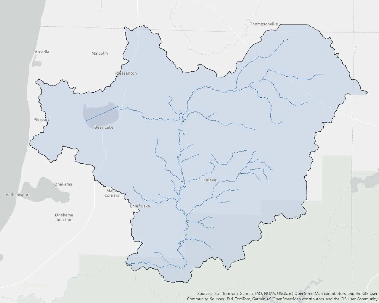
The Greater Bear Watershed consists of Bear Lake and Bear Creek located primarily in Manistee County, Michigan, with portions extending into Benzie and Wexford counties. The watershed encompasses 204 square miles, totaling 130,800 acres, and spans across 13 townships and multiple municipalities. Included in the watershed are Bear Lake, Bear Creek, and a number of tributaries to Bear Creek.
In 2025, the Bear Lake Watershed Alliance merged together with the Bear Creek Watershed Council to become the Greater Bear Watershed Alliance. This merger took many months of planning with much support from community members and partners to make it possible. Prior to the merger, two groups operated separately within the Greater Bear Watershed - the Bear Lake Watershed Alliance primarily focused efforts within the Bear Lake area, and the Bear Creek Watershed Council primarily focused efforts along the Bear Creek.
Bear Lake
Bear Lake formed naturally between 10,000 and 75,000 years ago. It covers approximately 1,744 surface acres and is about 24 feet deep at its maximum depth. About two-thirds of the lake is less than 20 feet deep. The volume of Bear Lake is estimated to be 26,503 acre-feet. The shoreline is estimated at 7.62 miles and at its widest dimension, it is about 2.38 miles.
The Bear Lake Watershed Alliance was founded in 2008 and was created with a mission to preserve, protect, and improve the health and natural character of Bear Lake’s watershed. The Bear Lake Watershed Alliance served for many years performing water testing within the lake, storm drain testing within the community, installing rain gardens around the community, and installing watershed road signs around the county. The group hopes to continue these projects now with a broader reach of the Greater Bear Watershed Alliance.
Bear Creek
Bear Creek is a Michigan Blue Ribbon Trout Stream and has a naturally reproducing population of brook trout in the headwaters. Bear Creek is a main tributary to the Manistee River, and its confluence at “White Fence” is downstream of Tippy Dam. Bear Creek is 28 miles long and covers 184 square miles. Bear Creek meanders southward across Manistee County before joining the Manistee River downstream of Tippy Dam. Though much of the upper headwaters and the last few miles of Bear Creek flow through publicly-owned and protected lands, most of the river and many of the tributaries flow through privately-owned lands.
The Bear Creek Watershed Council formed in 1990 and worked with many local partners on restoration efforts within the watershed, particularly streambank stabilization efforts and road/stream crossing inventory.
Together as One
The merger of the Bear Lake Watershed Alliance and the Bear Creek Watershed Council was unanimously approved at the July 26, 2025 annual meeting, officially joining the two groups into the Greater Bear Watershed Alliance. Now as the two organizations come together as one, we hope to accomplish more together as a unified group with a shared goal of improving our watershed.
The Greater Bear Watershed Alliance is a registered 501(c)(3) non-profit organization.
Greater Bear Watershed Management Plan
The first Bear Creek Watershed Management Plan was completed in July 2000 by the Conservation Resource Alliance, Bear Creek Watershed Council, and other project partners. The cooperative planning, management efforts and growing concerns over potential impairments to Bear Lake led residents in the area to seek resources for the development of a comprehensive watershed management plan that would update the 2000 plan and expand the scope to include the entire watershed, including Bear Lake. Therefore, the Greater Bear Watershed Management Plan, encompassing the entire Bear Lake Watershed, was approved by EGLE (formerly DEQ) on July 25, 2013.
Greater Bear Watershed Management Plan Executive Summary (July 2013)
Greater Bear Watershed Management Plan (July 2013)
Interim Progress Report on Watershed Management Plan Implementation (July 2014)